
UK Heatwave Finale: Thunderstorms and Flash Flood Risk
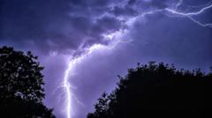
Final Day of UK Heatwave Brings Extreme Weather Shift
As the UK heatwave reaches its concluding phase, meteorologists warn that a dramatic transformation is underway. The UK heatwave thunderstorms expected to arrive will fundamentally alter weather patterns across the nation, bringing an abrupt end to prolonged heat conditions that have affected millions of residents throughout the country.
Southern and Eastern England Hit Heatwave Peak on Tuesday
Tuesday marks a crucial turning point for UK weather dynamics. Additional locations across southern and eastern England are anticipated to satisfy official heatwave criteria during this final critical day before conditions deteriorate significantly. Forecasters indicate that temperatures will climb to dangerous levels in select areas before the atmospheric system shifts dramatically.
Temperature Records Before the Transition
Before cooler air masses arrive, numerous communities in the southern regions are expected to experience temperatures consistent with heatwave classifications. This represents the last opportunity for these areas to reach peak warmth before a notable cooling trend dominates the forecast. Residents are advised to remain vigilant as conditions oscillate between extreme heat and severe weather phenomena within a compressed timeframe.
Thunderstorms Bring Flash Flood Dangers
The transition away from the UK heatwave thunderstorms pattern will introduce substantial precipitation risks. Meteorological services have issued warnings regarding potential flash flooding, particularly in vulnerable regions where ground saturation levels and topographical factors increase vulnerability to rapid water accumulation. These atmospheric disturbances will arrive with considerable intensity, potentially causing disruptions to transportation networks and infrastructure.
Regional Impact Assessment
Different regions will experience varying severity levels as the weather system progresses across the country. Eastern England may witness particularly intense conditions, with flash flood risk concentrated in areas prone to rapid runoff. Water drainage systems could become overwhelmed by the volume and speed of rainfall associated with these severe thunderstorms.
Cooling Trend on the Horizon
Following the passage of dangerous weather systems, substantially cooler temperatures will dominate weather patterns across the United Kingdom. This shift represents a dramatic reversal from the extended high-pressure systems that created the prolonged heatwave conditions. Relief from oppressive heat will be welcomed by many residents, though the transitional period will bring hazardous weather that demands caution and preparedness.
Preparation and Safety Measures
Authorities recommend that residents take appropriate precautions before the severe weather arrives. Securing loose outdoor items, checking drainage systems, and monitoring weather updates regularly will help minimize potential damage. Emergency services are positioned to respond rapidly to any flood-related incidents that may develop during the peak storm activity.
Understanding the Weather Pattern Shift
The transition from the UK heatwave thunderstorms scenario reflects fundamental changes in atmospheric pressure systems and air mass movements across the Atlantic. Cooler, more stable air moving southward will replace the heat dome that has persisted over recent weeks. This meteorological shift, while bringing some hazardous conditions initially, ultimately provides relief from sustained elevated temperatures that have challenged public health services and infrastructure resources.
Timeline and Progression
Tuesday represents the final peak before conditions change dramatically. By Wednesday and subsequent days, residents should expect significantly reduced temperatures and clearing conditions following the storm system's passage. The entire transition is expected to unfold over a compressed 24-to-48-hour window, making it essential for communities to prepare accordingly and remain informed through official weather channels and emergency alerts.


